GR34 Coastal Path St Malo: Complete 2027 Walking Guide to the Sentier des Douaniers

The GR34 coastal path from St Malo — also known as the Brittany Coast Path or Sentier des Douaniers — is one of the finest day walks in France. Voted France’s favourite long-distance trail in 2018, this clifftop linear walk along the Côte d’Émeraude (Emerald Coast) passes wild headlands, hidden coves, sheltered beaches, and the extraordinary sculpted granite rocks of Rothéneuf before reaching the great panorama of Pointe du Grouin. The route is perfectly suited to beginners and experienced walkers alike: well-waymarked, no technical skills required, and with bus connections at several key waypoints for a self-guided one-way walk. For anyone arriving on the Portsmouth–St Malo ferry, it is the ultimate car-free walking holiday — some of the most dramatic sections of the Brittany Coast Path are within a single day’s reach of the port gates.

Last updated: October 2026 | All information verified

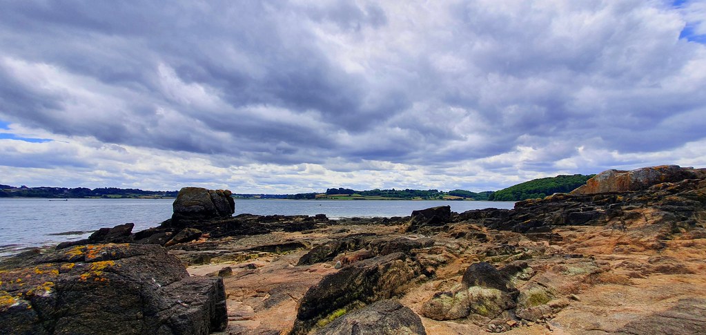
GR34 Coastal Path from St Malo Photo taken from the rocks looking over the water

Ready to Walk the GR34?

Book your Portsmouth to St Malo crossing with Brittany Ferries and step straight onto one of France’s finest coastal walks from the port gates.

Check Ferry Prices & Availability →

~2,000 km
Total Length
Mont-Saint-Michel to
Saint-Nazaire
~34 km
St Malo to
Cancale on the
GR34 coast path
1791
Year the
Customs Path
was Created
2 days
Best Split for
St Malo to
Cancale (~10 hrs)
  • ✅Sentier des Douaniers – France’s longest coastal path, created 1791 for customs officers patrolling Brittany’s coast
  • ✅Rochers Sculptés, Rothéneuf – 300+ granite carvings by the Abbé Fouré (1894–1907), a masterpiece of Art Brut just 5km from St Malo
  • ✅Pointe de la Varde – A protected Vauban headland fort with 180° panoramas over St Malo, Cap Fréhel, and Île Besnard
  • ✅Anse du Guesclin – A secluded bay with a tidal island accessible on foot at low tide, one of the coast’s hidden gems
  • ✅Pointe du Grouin – Brittany’s finest clifftop viewpoint: 360° panorama from Cap Fréhel to Mont-Saint-Michel and the Île des Landes seabird reserve
  • ✅Bus back on the MAT network – Walk one way, bus back: MAT Line 5 runs every day from Cancale, and Line 9, the “beach line”, stops along the coast at weekends and on public holidays — no car required
  • ✅Beginner-friendly coastal walking – No technical skills required, well-waymarked with red-and-white GR markers, and suitable for all fitness levels in shorter sections

What Is the GR34 Sentier des Douaniers?

The GR34 is one of France’s most celebrated long-distance walking routes, following the Breton coastline for around 2,000km. The name most walkers know it by — the Sentier des Douaniers, or Customs Officers’ Path — tells its origin story. Created in 1791 during the Revolutionary period, the path was designed to give customs officers a continuous patrol route along every bay and headland of Brittany’s dramatically indented coast, primarily to combat smuggling and watch for illegal coastal landings. Officers were required to walk a set section of the path every day, keeping the sea in view at all times.

From Smugglers’ Route to France’s Greatest Coastal Walk

The path fell into disuse after the early 20th century when motorised customs patrols replaced foot patrols. It was reclaimed from the bracken and gorse by hiking volunteers from 1968 onwards and officially incorporated into France’s GR (Grande Randonnée) network as GR34 — making it part of the same national walking infrastructure that includes the famous GR20 in Corsica and GR10 in the Pyrenees. Today it is maintained by the FFRandonnée (French Hiking Federation) and its network of thousands of volunteer path-markers, who keep the distinctive red-and-white waymarks fresh and the path clear. In 2018 it was voted France’s favourite GR trail — a recognition that has never been seriously challenged.

The full Brittany Coast Path (GR34) runs from Mont-Saint-Michel in the north to Saint-Nazaire at the mouth of the Loire, taking in every dramatic feature of the Breton coastline: the pink granite of the Côte de Granit Rose, the wild Finistère headlands, the sheltered Morbihan gulf, and the spectacular Emerald Coast that passes St Malo’s doorstep. Most walkers tackle it in sections rather than all at once. The section immediately accessible from St Malo — east towards Cancale and west towards Dinard — is among the best of the entire route.

The Côte d’Émeraude: Why St Malo’s Section Is Special

The stretch of GR34 between St Malo and Cancale follows the Côte d’Émeraude — the Emerald Coast — named for the extraordinary colour of its shallow tidal waters. This is not a uniform clifftop path. It is constantly varied: clifftop ledge walking above crashing Atlantic swells, descents to wide sandy beaches accessible only at low tide, narrow headland promontories jutting into the sea, sheltered harbour coves where oyster boats rest on the sand, and the extraordinary wildlife of Pointe du Grouin’s seabird reserve. The path’s character changes every few kilometres. It rewards slow walkers who stop often and look out to sea.

The GR34 Route from St Malo: Key Sections and Distances

The GR34 runs in both directions from St Malo. This guide focuses on the eastern section towards Cancale — the route most accessible for day-trippers arriving on the Portsmouth ferry. The western section (St Malo to Dinard via the Rance estuary barrage) is also excellent but shorter and differently characterised. The distances below are for the Cancale direction. Following every headland and cove, the coastal path is around 34km — far longer than the direct inland walk of about 14km, or the 19km Vélomaritime (EuroVelo 4) cycle route between the two towns.

St Malo → Cancale: GR34 Waypoints & Distances

WaypointDistance from St MaloWalk Time (cumulative)Highlights
St Malo RampartsStart—Walk the ramparts east, city views, Île de Cézembre
Pointe de la Varde~4 km~1 hr 10 minVauban headland fort, 180° sea panorama
Rothéneuf~6 km~1 hr 45 minRochers Sculptés (€5), harbour, café stops, MAT Lines 3, 4 and 9
Anse du Guesclin~15 km~4 hrs 20 minTidal island, Île Besnard loop option, beach swimming
Pointe du Grouin~27 km~7 hrs 45 min360° panorama, Île des Landes bird reserve, Île des Rimains, orientation table
Cancale Port de la Houle~34 km~10 hrsOyster market, harbour, bus back on MAT Line 5 (daily) or Line 9 (weekends)

Distances are approximate, taken from GPS tracks of the coastal path (around 33.5–34km in total). Times assume a walking pace of ~3.5km/hr with brief stops — most walkers split the full route over two days, overnighting around Anse du Guesclin or Saint-Coulomb.

The GR34 West: St Malo to Dinard (and Beyond to Fort La Latte)

The GR34 also runs west from St Malo, past Saint-Servan and along the Rance estuary, crossing the Rance barrage to reach Dinard — approximately 8–9km, 2.5–3 hours one way. The route passes the historic Cité d’Alet (St Servan), with its Gallo-Roman walls and Vauban citadel, and the Tour Solidor — a remarkable 14th-century triple keep offering views over the Rance. You also pass within sight of Grand Bé island, where the Romantic writer Chateaubriand chose to be buried, and the Fort National, accessible at low tide from St Malo’s beaches. The Rance estuary barrage (the world’s first tidal power station, opened 1966) makes for a spectacular crossing. Return to St Malo on the Compagnie Corsaire sea-bus (a 10-minute crossing — check seasonal sailing times) or by bus. Our Dinard day trip guide covers what to do when you arrive.

Continuing further west from Dinard, the GR34 eventually reaches Fort La Latte — one of the most dramatically sited medieval castles in France, perched on a headland above the sea — and Cap Fréhel, whose 70-metre sea cliffs and seabird colonies (guillemots, razorbills, fulmars, kittiwakes and shags — France’s largest guillemot and razorbill colony) are among the finest ornithological sites in northern France. Fort La Latte to Cap Fréhel is a popular half-day walk in its own right, and the Sept Îles archipelago further west hosts the largest seabird colony in France. These destinations are day-trip distance from St Malo by car (Cap Fréhel is approximately 40km west) — see our Cap Fréhel and Fort La Latte day trip guide.

Getting to St Malo by train: St Malo is connected to Rennes by direct TER train (approximately 1 hour), and Rennes is served by TGV from Paris Montparnasse (1hr 30min). For walkers travelling from the UK without a car, the Portsmouth–St Malo ferry remains the most direct route — but the Rennes rail connection means the GR34 is also easily accessible for visitors based elsewhere in France.

The Route in Detail: St Malo to Cancale on the GR34

This section walks you through the full eastern route section by section, so you can plan exactly how much of it to take on. The path is waymarked throughout with red-and-white GR stripes — follow these at all junctions.

Stage 1: St Malo Ramparts to Pointe de la Varde (~4km)

The walk begins on St Malo’s great granite ramparts, which are classified as a French Monument Historique. Head east along the walls past the Tour Bidouane, enjoying sweeping views across the tidal flats and out to Île de Cézembre. The GR34 waymarks pick up as you leave the city walls and the path follows the shoreline east through the Courtoisville suburb and out onto the open coast. Within 4km, the path rises to Pointe de la Varde — a former Vauban fortification and Second World War German defensive emplacement that now functions as a protected natural headland. The views from the point cover 180°: St Malo’s ramparts behind you, the great sweep of the bay ahead, Cap Fréhel on the western horizon, and on clear days the distant profile of the Channel Islands.

Facilities: Cafés and shops in St Malo’s Paramé suburb. No facilities between Paramé and Rothéneuf. Note: This first section is a good turnaround point for anyone wanting a shorter walk — return to St Malo from Pointe de la Varde in under an hour.

Stage 2: Pointe de la Varde to Rothéneuf (~2km)

A short descent from the headland brings you into the harbour village of Rothéneuf, a former fishing community of weathered stone houses that became a minor seaside resort in the late 19th century. The GR34 passes close to the harbour — a shallow tidal inlet surrounded by low granite walls — and then continues around the headland past the Rochers Sculptés. Rothéneuf is worth a pause: there are cafés, a boulangerie, and the extraordinary carved rocks which the path skirts. MAT buses stop here, making it the most popular access point for people doing a half-day walk back towards St Malo or onwards to Anse du Guesclin.

Bus stop: Les Îlots (Rothéneuf) — MAT Line 3 runs to St Malo Intra-Muros every day, Line 4 also serves Rothéneuf, and Line 9 stops here at weekends. Facilities: Cafés, boulangerie, toilets, car parking near the Rochers Sculptés.

Stage 3: Rothéneuf to Anse du Guesclin (~9km)

This middle section is where the GR34 opens up into its most varied character. Beyond Rothéneuf the path passes Île Besnard — a small tidal island at the mouth of the harbour that can be circumnavigated as an optional loop — before continuing through a series of rocky headlands and small beaches, including La Guimorais beach and Pointe du Meinga. The path alternates between clifftop ledges with sea views and short descents to cove beaches that are swimmable in summer. Some beach sections are only accessible at low tide; signed road diversions are provided for high-tide conditions. Check tide times before setting out if you want to keep entirely on the coastal path.

The section arrives at Anse du Guesclin — one of the most beautiful bays on the entire Emerald Coast. A small tidal island, Fort du Guesclin, sits at the bay’s entrance. At low tide you can walk across the sandy causeway to the island. The bay itself is sheltered, with fine sand and relatively calm water — an excellent swimming stop in summer. The site has medieval associations and the area is named after Bertrand du Guesclin, the celebrated 14th-century Breton warrior and Constable of France.

Bus stop: Fort du Guesclin — MAT Line 9 (weekends and public holidays). Facilities: Seasonal café at Anse du Guesclin in summer. No facilities between Rothéneuf and here.

Stage 4: Anse du Guesclin to Pointe du Grouin and on to Cancale (~19km)

From Anse du Guesclin, the path continues past Plage du Verger and Plage de la Saussaye before rising steadily towards the coast’s highest and most dramatic point — Pointe du Grouin. The clifftop sections here become more exposed, with yellow gorse, purple heather, and golden broom dominating the clifftop heath in spring and summer. At Pointe du Grouin (around 40m above the sea), the view is genuinely arresting: a 360° panorama sweeping from Cap Fréhel to the west, across the great arc of the bay, to the distant silhouette of Mont-Saint-Michel and the Channel Islands. Directly below lies Île des Landes — an uninhabited bird reserve managed by Bretagne Vivante since 1961, home to shags, large gull colonies, shelducks and oystercatchers — and to the east, the small rocky islet of Île des Rimains is clearly visible in the bay. An orientation table on the headland identifies landmarks up to 70km away.

From Pointe du Grouin, the path descends to Cancale along a balcony path past Port-Mer — a beautiful sandy bay that is excellent for swimming in summer — and the little coves of Port-Pican and Port-Briac, with oyster tables visible across the tidal flats. The final 7km section from Pointe du Grouin to Cancale’s Port de la Houle is covered in detail in the Cancale Day Trip Guide. The oyster market is the perfect finish: oysters from about €6 a dozen, eaten on the harbour wall with Mont Saint-Michel on the horizon.

Note on Pointe du Meinga: Just before Anse du Guesclin, the path rounds Pointe du Meinga — an easy and very rewarding stretch around 46m above the sea, with wide views across the bay to Île des Landes and Île de Cézembre. As on any clifftop path, stick to the waymarked route and keep young children close. Bus stops: there is no stop at the headland itself — the nearest Line 9 stops are Le Verger and Port Mer (weekends and public holidays). From Cancale Église, MAT Line 5 runs back to St Malo every day.

The Rochers Sculptés at Rothéneuf: An Art Brut Masterpiece on the Coastal Path

One of the most extraordinary sights on the entire GR34 coastal path near St Malo lies just 5km from the ramparts, carved directly into the granite cliff face at Rothéneuf. The Rochers Sculptés are a remarkable work of obsessive outsider art — a 500m² cliff of granite figures, monsters, corsairs, and mythical creatures, created over 13 years by a deaf priest working alone with nothing but a chisel and extraordinary determination.

The Abbé Fouré and His Granite World

Adolphe Julien Fouéré, known as the Abbé Fouré, was born in Brittany in 1839 and ordained as a priest in 1863. He served parishes in Brittany for 31 years until a stroke in 1894 left him deaf and largely mute. Unable to continue his ministry, he retired to Rothéneuf — then a quiet fishing hamlet — as a “prêtre habitué” (resident priest). There, isolated by his disability, he began carving the rocks that lined the cliff above the sea.

For around 13 years — from late 1894 until a second stroke in 1907 stopped him — the Abbé worked on the cliff face, creating over 300 sculptures directly from the living granite. His main subject was the legend of the Rothéneuf family, a local clan of corsairs, pirates or wreckers said to have ruled this stretch of coast. Around their story he wove a fantastical menagerie: sea monsters, demons, saints such as Saint Budoc, local people, figures from the news of his day, Breton explorer Jacques Cartier, and allegorical scenes of paradise and hell.

The Abbé Fouré is now recognised as a major figure in Art Brut — the French term for raw, visionary art created outside the traditions of fine art and without formal training. His work sits alongside the great outsider artists of the 20th century, though he predated the concept by decades. He died at Rothéneuf in February 1910 and is buried in the village cemetery. The figures he created — worn by over a century of salt wind and Atlantic spray, many now eroded beyond recognition — continue to draw tens of thousands of visitors every year to this quiet headland above the sea.

Visiting the Rochers Sculptés: Practical Information

  • Location: Rothéneuf, 5km east of St Malo along the GR34 (or MAT bus to Rothéneuf)
  • Admission: Adults €5 | Under 18 €3 | Under 10 Free
  • High season hours (July/August): 9:00am – 7:00pm (continuous)
  • Mid-season hours (March–June, September–October): 10:00am–12:00pm and 2:00pm–6:00pm
  • Low season (November, December, February): 10:00am–12:00pm and 2:00pm–5:30pm
  • Important: The site is not suitable for pushchairs. Sturdy footwear essential — the visit involves walking on uneven rock surfaces.
  • Parking: Shared car park with the Bénétin restaurant near the site. A free section of carved granite is visible from the public path outside the paid entrance — you can see some of the work without paying.

Getting to the GR34 from St Malo: Bus Options for Day Walkers

One of the great practical advantages of the St Malo section of the GR34 is that the MAT bus network serves several key waypoints along the coastal path. This makes the GR34 a genuine car-free walking holiday — you can do the walk one-way and bus back, or bus out to a mid-point and walk back to St Malo, with no car needed and no retracing your steps. For ferry passengers stepping off in St Malo, the path is walkable from the port gates without any further transport at all — and with the overnight ferry from Portsmouth arriving at 08:45, you can be on the path by mid-morning. Bear in mind that Line 9, the coastal “beach line”, runs on Saturdays, Sundays and public holidays all year; on weekdays, use Line 3 or 4 for Rothéneuf and Line 5 for Cancale.

MAT Bus Services for GR34 Walkers

LineRouteGR34 StopsSeason
Line 9 (“beach line”)St Malo Intra-Muros → Rochebonne → Pont → Les Îlots (Rothéneuf) → La Touesse → Fort du Guesclin → Le Verger → Port Mer → Port Picain → Port Briac → Cancale ÉglisePont (for Plage de la Varde), Les Îlots, Fort du Guesclin, Le Verger, Port Mer, CancaleSaturdays, Sundays and public holidays, all year
Lines 3 & 4Rothéneuf Les Îlots ↔ St Malo (Line 3 to Intra-Muros, Line 4 to Renoir)RothéneufEvery day, all year
Line 5Cancale Église ↔ St Malo BriantaisCancale (return from Cancale to St Malo — useful if finishing the walk)Every day, all year

Note: The MAT network was restructured in January 2025. Always verify current timetables and stop names at www.reseau-mat.fr before travelling. Line numbers, stops and frequencies may change, and there is no Line 9 stop at Pointe du Grouin itself — use Le Verger or Port Mer.

Best One-Way Walk Combinations

  • Half day (2 hours): Bus Line 3 to Rothéneuf Les Îlots (every day) → walk back to St Malo via Pointe de la Varde. ~6km, mostly level. Visit the Rochers Sculptés before you start walking.
  • Day walk (4–5 hours): Bus Line 9 to Fort du Guesclin (weekends and public holidays) → walk back past Pointe du Meinga, Rothéneuf and Pointe de la Varde to St Malo. ~15km, the most varied section of the route.
  • Half to full day (3–4 hours): Bus Line 9 to Le Verger (weekends and public holidays) → walk up to Pointe du Grouin and on to Cancale (around 7km from the headland, about 2 hours) → oysters at the market → bus Line 5 back to St Malo. A spectacular day out combining the best of the GR34 with the Cancale oyster experience.
  • Two-day linear (around 10 hours walking): Walk the full ~34km from St Malo to Cancale, overnighting near Anse du Guesclin → bus Line 5 back from Cancale Église (every day). The most rewarding option for experienced walkers, and it works all year.

What to Expect: Trail Conditions, Difficulty and Gear

Trail Surface and Terrain

The GR34 coastal path near St Malo is not a single type of surface. In a typical 5km stretch you might encounter: packed earth clifftop path, granite rock steps, loose shingle on headland descents, sandy beach walking at low tide, wooden boardwalk sections, and occasional stretches of quiet road through hamlets. The variety is part of the appeal but it means you cannot treat this like a paved promenade walk.

The route is suitable for any moderately fit walker — the terrain is not technically demanding, but involves frequent short climbs and descents, some rock steps, and several stretches close to unfenced cliff edges. None of the climbs are long — the path rarely rises much above 40m — but they add up: GPS tracks of the full St Malo to Cancale route record roughly 950–1,350 metres of total ascent over around 34km. That is a demanding distance for one day — think of a tough day on a hilly stretch of the British South West Coast Path — which is why most walkers split it in two.

Tides and High-Water Diversions

The Emerald Coast has some of the largest tidal ranges in France — up to 14 metres at spring tides near Cancale. This dramatically affects the path in two ways. First, several sections of the route cross beaches or rocky foreshores that are impassable at high water. These sections all have signed road diversions (variante marée haute) marked on the path. Second, the landscape itself is transformed by the tide — at low water you can walk vast expanses of sand and see the oyster beds; at high water the cliffs drop straight into the sea. Both have their beauty.

The practical rule of thumb: if you plan to walk any of the beach sections at low tide, check the tide forecast before leaving St Malo. Aim to be on the beach sections in the two hours before or after low water to give yourself comfortable margins. Free tide times for St Malo are available at tide-forecast.com. If in doubt, take the road diversion — it is always signposted.

What to Wear and Bring

  • Footwear: Waterproof trail shoes or walking boots are essential. The path is often muddy, rocky, or wet underfoot — road trainers are not adequate, sandals are dangerous.
  • Waterproof jacket: Carry one regardless of the forecast. Brittany has an oceanic climate — Atlantic weather on this coast is changeable and the exposed headlands offer no shelter from sudden squalls, even in summer.
  • Water: At least 1 litre per person for a half-day walk, 2 litres for a full day. There are café stops at Rothéneuf, Anse du Guesclin (seasonal), Pointe du Grouin, and Cancale.
  • Navigation: The path is well-waymarked (red-and-white GR stripes) — no map is strictly necessary, but the IGN TOP 25 map 1116ET (Saint-Malo / Dinard / Dinan, 1:25,000), which covers the coast as far as Pointe du Grouin, or a GPX file from mongr.fr is recommended for the full route.
  • Sunscreen: The clifftop path is highly exposed. Even in spring and autumn, a full day’s walk involves significant sun exposure. This is regularly underestimated by visitors from the UK who associate Brittany with overcast Atlantic weather.

Wildlife on the GR34 Near St Malo

The Emerald Coast section of the GR34 passes through habitats of genuine ecological richness. The combination of Atlantic cliffs, sheltered coves, tidal mudflats, and the extraordinary productivity of the Bay of Mont-Saint-Michel makes the St Malo section exceptional for wildlife watching, particularly birds.

🦅 Île des Landes & Île des Rimains, Pointe du Grouin

The uninhabited Île des Landes directly below Pointe du Grouin is a protected bird reserve, managed by Bretagne Vivante since 1961, where shags, great black-backed, lesser black-backed and herring gulls, shelducks and oystercatchers breed. Gannets are often seen diving offshore, peregrine falcons hunt along the cliffs, and rock pipits, linnets and stonechats flit through the heath on the headland. The smaller Île des Rimains is visible to the east. Birdwatchers should bring binoculars — the orientation table on the headland points directly at the reserve.

🌿 Coastal Wildflowers

The clifftop heathland bursts into colour in spring. Western gorse (ajoncs) blooms from February through May, turning whole headlands golden. Broom follows in April and May, adding splashes of vivid yellow alongside the gorse. Sea thrift (armeria), sea campion, and wild carrot follow through summer, with purple heather flowering from August. The gorse, broom, and heather provide vital habitat for stonechat, whitethroat, and linnet, all easily spotted at close range on the path-side vegetation.

🐬 Marine Wildlife in the Bay

Common bottlenose dolphins are regularly spotted from the high clifftop sections, particularly around Pointe du Grouin where the tidal currents concentrate fish. Grey seals occasionally haul out on the rocky islets. The bay’s tidal mudflats attract vast numbers of wading birds — dunlin, oystercatcher, knot, and curlew — particularly on autumn passage and in winter.

🐧 Further West: Cap Fréhel’s Seabird Cliffs

If you continue west on the GR34 or take a day trip, the 70-metre cliffs of Cap Fréhel hold France’s largest colony of guillemots and razorbills, alongside fulmars, kittiwakes, shags and great black-backed and herring gulls. Guillemots and razorbills are on the cliffs in spring and early summer, until the chicks leave the ledges in June. Bring binoculars — the birds nest on ledges best seen from the clifftop path.

When to Walk: Season by Season Guide

🌸 Spring (April–June)

The path’s best season for most walkers. Gorse, broom, and wildflowers at their peak; mild temperatures (12–20°C); daylight until 9:30pm in June. May weekdays are often quiet — the path largely to yourself except for local dog walkers. Some cafés and Rochers Sculptés operate reduced hours in April–May (10am–noon and 2pm–6pm). On weekdays, plan around Lines 3 and 5, as the coastal Line 9 runs only at weekends and on public holidays. Perfect for wildlife watching.

☀️ Summer (July–August)

Warm and long days (18–25°C); all facilities open; check the summer timetable for the Line 9 beach bus. The path is busier — particularly on weekend afternoons and near beaches — but never uncomfortably crowded. Start early (before 9am) to have the best sections to yourself. The sea is warm enough to swim at the beach coves (around 17–19°C). Book accommodation in Cancale and along the route well in advance.

🍂 Autumn (September–October)

Excellent for walking. Temperatures still pleasant (14–20°C), crowds have thinned, the quality of light on the granite and sea is extraordinary in September. Oysters at Cancale enter their best season (September through April). Most attractions remain open through October. The preferred season of many experienced walkers on this route.

❄️ Winter (November–March)

Thanks to Brittany’s oceanic climate, winters here are mild by Atlantic European standards — temperatures rarely drop below 5°C and snow is exceptional. The path is open year-round and has a wild, elemental appeal in winter — the exposed headlands above crashing grey seas, entirely to yourself. Atlantic gales can make the open clifftop sections genuinely arduous on storm days. Stick to shorter sections (St Malo to Rothéneuf and back) in bad weather. Several cafés and attractions close or reduce hours between November and February.

Multi-Day Walking: Accommodation, Gîtes and Luggage Transfer on the GR34

Not everyone wants to limit themselves to a single day’s walk. The GR34 near St Malo is also an exceptional self-guided multi-day walking itinerary — well suited to anyone arriving on the Portsmouth–St Malo ferry who has 2–4 days to explore the coast on foot. Here’s everything you need to plan an overnight or multi-day walk on this section of the Brittany Coast Path.

Accommodation on the GR34: Gîtes, Chambres d’Hôtes and Hotels

The St Malo to Cancale section of the GR34 is very well served for accommodation. St Malo and Cancale both have a full range of hotels, guesthouses, and self-catering options. Along the route, the key overnight options are:

  • Gîtes d’étape — Walking-specific hostel accommodation, providing a bunk bed, meals, and a warm welcome to walkers. The most affordable option and socially very enjoyable. The FFRandonnée maintains an official list of gîtes on the GR34 at mongr.fr.
  • Chambres d’hôtes (B&Bs) — French B&Bs are excellent on this coast: typically family-run, with good evening meals available and a warm atmosphere. Rothéneuf, Saint-Coulomb, and Cancale all have good options.
  • Camping and wild camping — Designated campsites operate along the coast in summer; wild camping (bivouac) is technically not permitted on the GR34 in Brittany, though low-impact camping away from towns is widely practised. Always ask landowner permission.
  • Hotels in Cancale — For a full day’s walk finishing with oysters, Cancale makes an excellent overnight base. Booking in advance is essential in July and August, when accommodation fills weeks ahead.

Luggage Transfer: La Malle Postale

Walking long-distance with a heavy rucksack is one of the quickest ways to turn a pleasure into a chore. La Malle Postale, an official FFRandonnée partner, is one of the luggage transfer services on the GR34 — they collect your bags from your accommodation each morning and deliver them to your next overnight stop, leaving you free to walk with only a daypack. The service covers the Emerald Coast section and is highly recommended for multi-day walkers who want to walk the full route at a relaxed pace.

La Malle Postale: www.lamallepostale.com — FFRandonnée members and RandoPass holders get 5% off the luggage service (one bag per person).

Suggested GR34 Itineraries from St Malo (2–4 Days)

  • 2 days (St Malo → Cancale): Day 1: Walk St Malo to Rothéneuf (~6km, with Rochers Sculptés visit), continue past Pointe du Meinga to Anse du Guesclin (~15km total). Overnight in Saint-Coulomb. Day 2: Walk past Plage du Verger to Pointe du Grouin and on to Cancale (~19km). Oysters at the market, return to St Malo by MAT Line 5.
  • 3 days: Add the GR34 west section on Day 3: St Malo to Dinard (8–9km, via Tour Solidor and the Rance barrage). Return on the Compagnie Corsaire sea-bus across the Rance or by bus.
  • 4 days (heading west): On Day 4, continue west from Dinard on the GR34 towards Saint-Lunaire and Saint-Briac, or take a day trip to Cap Fréhel and Fort La Latte — Fort La Latte to Cap Fréhel is one of the most spectacular half-day walks in all of France. The Cicerone guidebook to the Brittany Coast Path covers these western stages in detail.

GR34 St Malo Frequently Asked Questions

What is the GR34 coastal path near St Malo?

The GR34 is France’s longest coastal walking route — the Sentier des Douaniers (Customs Officers’ Path) — tracing the Breton coastline for around 2,000km from Mont-Saint-Michel to Saint-Nazaire. Voted France’s favourite long-distance trail in 2018, it is waymarked throughout with red-and-white GR stripes. Near St Malo, the path runs east along the Côte d’Émeraude, passing Pointe de la Varde, Rothéneuf, the Anse du Guesclin, and Pointe du Grouin before reaching Cancale — around 34km of the most varied and scenically dramatic walking in Brittany, with shorter sections easily done as a day trip from St Malo.

How far is the GR34 walk from St Malo to Cancale?

The GR34 coastal path from St Malo to Cancale is around 34km (21 miles) one way, because it follows every headland and cove. That is roughly 10 hours of walking, so most people split it over two days. For comparison, the direct inland walk is about 14km and the Vélomaritime cycle route is 19km. The terrain involves regular short climbs and descents — particularly around Pointe du Grouin — but nothing technically demanding. Many day-trippers take a MAT bus to a mid-point instead — Line 3 to Rothéneuf every day, or Line 9 to Fort du Guesclin or Le Verger at weekends — and walk from there. MAT Line 5 links St Malo and Cancale every day.

Can I do the GR34 as a day trip without a car?

Yes — the St Malo GR34 is one of France’s best car-free walking holidays. MAT Line 9, the “beach line”, runs from St Malo Intra-Muros past Rothéneuf, Fort du Guesclin, Le Verger and Port Mer to Cancale on Saturdays, Sundays and public holidays all year. Every day, Line 3 serves Rothéneuf and Line 5 links Cancale with St Malo. You can take the bus to a waypoint and walk one-way back to St Malo, or walk east and bus back. Ferry passengers from Portsmouth can step straight off the boat and onto the path. Always verify current timetables at www.reseau-mat.fr.

What are the best shorter GR34 walks from St Malo?

Three options suit different abilities and time available. (1) St Malo to Rothéneuf: ~5–6km, about 2 hours, easy, ending at the Rochers Sculptés — bus back on Line 3 (every day). (2) Bus to Rothéneuf, walk back to St Malo via Pointe de la Varde: same distance, same effort, starts with a bus and ends on foot — good if you prefer to finish where you started. (3) Bus Line 9 to Le Verger (weekends), walk via Pointe du Grouin to Cancale (about 3 hours), oysters at the market, then Line 5 back to St Malo — the most rewarding shorter option combining the best scenery with a destination finish.

What are the Rochers Sculptés at Rothéneuf?

The Rochers Sculptés are 300+ granite carvings made directly into the coastal cliff at Rothéneuf by the Abbé Adolphe Fouré between 1894 and 1907. The Abbé — a priest who became deaf and mute after a stroke — spent around 13 years creating this extraordinary Art Brut work: figures representing the Rothéneuf family of corsairs, sea monsters, saints, and mythological scenes. The site covers 500m² and is 5km east of St Malo along the GR34. Admission: Adults €5, under 18 €3, under 10 free. Hours vary by season. Not pushchair accessible.

What is the history of the GR34 Sentier des Douaniers?

The Sentier des Douaniers was created in 1791 to give French customs officers a continuous patrol route along the entire Breton coastline, primarily to combat smuggling. Officers walked the path daily, watching every bay and cove for illegal activity. The path fell into disuse in the early 20th century and was painstakingly restored from 1968 by hiking volunteers. Officially designated as GR34 by the FFRandonnée, it now forms a coastal walking route of around 2,000km — France’s longest — from Mont-Saint-Michel to Saint-Nazaire, tracing four Breton departments and some of the most dramatic Atlantic coastline in Europe.

What is the best time of year to walk the GR34 from St Malo?

May, June, and September are the best months for most walkers. The coastal wildflowers are at their peak, temperatures are pleasant (12–22°C), the path is not overcrowded, and the quality of light on the Emerald Coast granite is exceptional. July and August are busiest but still excellent — start early. September also coincides with the best season for oysters at Cancale if you plan to combine the walk with a harbour lunch. Winter is possible but exposed headland sections can be challenging in Atlantic gales.

How difficult is the GR34 near St Malo?

The St Malo section is rated moderate and is suitable for any moderately fit walker — no technical skills are required. It involves frequent short climbs and descents with some rock steps, and several stretches are close to unfenced cliff edges. GPS tracks of the full St Malo–Cancale route record roughly 950–1,350 metres of total ascent over around 34km, so most walkers split it over two days. Solid waterproof walking shoes are essential; road trainers or sandals are not adequate. Some beach sections are only accessible at low tide and require checking tide times in advance. The path is not suitable for pushchairs or wheelchairs.

Is the GR34 walk from St Malo suitable for children?

Yes, in shorter sections. St Malo to Rothéneuf (5–6km, about 2 hours) is manageable for children aged 6+ and ends at the Rochers Sculptés, which children find fascinating. The Pointe du Grouin to Cancale section (7km) is also popular with families. The full 34km St Malo–Cancale walk is far too long for most children. All sections involve uneven rocky terrain requiring proper footwear; cliff edges on headland sections are unfenced and require close supervision. The Île Besnard loop near Rothéneuf makes an enjoyable short family outing in its own right.

What should I wear and bring for the GR34 walk?

Essential: waterproof trail shoes or walking boots, waterproof jacket, at least 1 litre of water per person (2 litres for the full walk), sunscreen. Recommended: a lightweight daypack, snacks, your phone with a GPX file downloaded from mongr.fr, and tide times from tide-forecast.com if you want to use the beach sections. Café stops exist at Rothéneuf, Anse du Guesclin (seasonal), Pointe du Grouin, and Cancale — so you don’t need to carry a full day’s food supply. The walk ends at Cancale’s oyster market, so save some appetite.

How do I navigate the GR34 — are there waymarks?

The GR34 uses the standard French GR waymarking system: horizontal red-and-white painted stripes on posts, rocks, trees, and walls at regular intervals. The markings are generally frequent and clear enough that a map is not essential on the main path. Near villages and where the route briefly joins roads, waymarks can be less obvious — look for them at head height on gateposts and walls. A free GPX track is available from the FFRandonnée’s official website at mongr.fr, which works with any GPS app including OS Maps, Komoot, or Gaia GPS.

Is the GR34 suitable for beginners?

Yes — the St Malo section is an excellent choice for beginner walkers, provided you pick an appropriate section. No technical skills are required, the path is well-waymarked throughout, and bus stops at Rothéneuf (daily), Fort du Guesclin and Le Verger (weekends) mean you can cut the walk short at several points. The 5–6km St Malo to Rothéneuf section is a perfect beginner’s outing — well-surfaced for most of the way, modest elevation changes, and ending at the Rochers Sculptés. The terrain does become rockier and more uneven east of Rothéneuf, so sturdy waterproof footwear (not trainers) is non-negotiable whatever your experience level.

Can you camp on the GR34 near St Malo?

Designated campsites operate near the route at Cancale and Saint-Coulomb. Wild camping (bivouac) is not officially permitted in Brittany’s coastal protected areas. For budget walkers, gîtes d’étape (walkers’ hostels) along the Emerald Coast section provide bunk beds and evening meals — see the FFRandonnée’s official list at mongr.fr. Chambres d’hôtes (B&Bs) and small hotels in Rothéneuf, Saint-Coulomb, and Cancale offer comfortable alternatives. July and August accommodation fills fast — book early, or consider the shoulder months of June or September when availability is much better and the crowds are thinner.

What are tidal coefficients and why do they matter on the GR34?

Tidal coefficients are a French measurement system (scale 20–120) describing the daily tidal range. The higher the coefficient, the bigger the tide — on high-coefficient spring tide days (above 90), beach sections of the GR34 become impassable for longer. The practical rule: aim to cross beach sections within two hours either side of low water. Tide times and daily coefficients for St Malo are available free at tide-forecast.com. Signed road diversions (variante marée haute) are provided on the path wherever sections flood at high tide — always follow these signs rather than attempting a submerged crossing.

Does the GR34 coastal path start in Saint-Malo?

No — officially, the GR34 begins at Mont-Saint-Michel in Normandy and finishes around 2,000km later at Saint-Nazaire, so Saint-Malo is not the trail’s starting point. That said, Saint-Malo is one of the most popular places to join the path, sitting several days’ walk from the official start — and it’s the natural starting point for ferry passengers arriving from Portsmouth. Many walkers treat “Saint-Malo to Mont-Saint-Michel” (usually 4–6 days around the bay) or the shorter “Saint-Malo to Cancale” stretch (around 34km, covered above) as self-contained routes, even though technically they’re joining the GR34 partway through rather than walking it from the official start.

Continue Planning Your Portsmouth to St Malo Trip

🛏️

Cabin Guide

Every cabin grade on MV Saint-Malo and Armorique — from 4-berth to Admiral suite

Cabins Guide →

⏰

Ferry Timetable

Full 2027 sailing schedule — departure times, seasonal dates, and frequency

Timetable →

⚓

Portsmouth Port Guide

Parking, getting there, terminal facilities, check-in and EV charging at Portsmouth port

Port Guide →

🦪

Cancale Day Trip Guide

The GR34’s destination: oyster market prices, parking, La Ferme Marine, restaurants

Cancale Guide →
Ready to Walk the GR34?

Book your Portsmouth to St Malo crossing with Brittany Ferries and step straight onto one of France’s finest coastal walks from the port gates.

Check Ferry Prices & Availability →